GV MODERN SURVEYORS
0
GV MODERN SURVEYORS
0
GV Modern Surveyors
Land surveyors
Across India · Since 2014
13.0023° N · 80.0945° E
Field operations · All days

Field Operations. Data Acquisition.

Topographic surveying, boundary fixing, and construction marking. Direct field execution since 2014.

WhatsApp us now Call 80728 07474
10000+ projects 12+ years 5 Teams Active
/ 01 FIELD RECORD
10000+
Projects Completed.
/ 02 EXPERIENCE
12+
Years Active.
/ 03 CAPACITY
500+
Projects per Year.
/ 04 OPERATIONS
5
Active Field Teams.
PRECISION AT EVERY SCALE • CLOSE TO ZERO TOLERANCE • 12 YEARS FIELD EXPERIENCE • GOVERNMENT FMB EXPERTS • PRECISION AT EVERY SCALE • CLOSE TO ZERO TOLERANCE • 12 YEARS FIELD EXPERIENCE • GOVERNMENT FMB EXPERTS •
01
How land gets measured

You send us a location.

Send one message on WhatsApp. Tell us where your site is and what you need. No forms. No office visit.

STEP 01 · ENQUIRY RECEIVED
GV
GV Modern Surveyors
online
Need a boundary survey for a plot in Porur. Possible this week?9:14 AM
Yes sir. Can send a team tomorrow morning. Share the location pin?9:15 AM
📍 Sharing now9:15 AM
Got it. Team confirmed for 8 AM tomorrow.9:16 AM
02
How land gets measured

We arrive the next morning.

A field team reaches your site at first light. Total station, DGPS when the job needs it, and a thousand surveys of experience behind every reading.

STEP 02 · 13.0023° N · 80.0945° E · ON SITE
03
How land gets measured

You get a signed report.

You get drawings, boundary marks, and a signed report. Valid for registration, bank and approval. Sent on WhatsApp, hard copy if you need one.

STEP 03 · REPORT ISSUED · SIGNED
GV MODERN
SURVEYORS
· SIGNED ·
/ 02 AVAILABILITY

We show up.
Every single day.

Same-day reply, guaranteed.

Send us a message now. You will hear back today, with a visit date and the team assigned to your site.

No weekends off. No waiting list.

We run field teams every day of the week. If you need a survey done this week, we can almost always make it happen.

Check availability on WhatsApp
/ 03 FIELD EVIDENCE
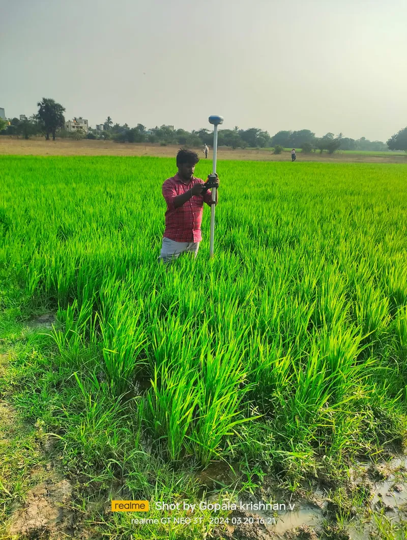
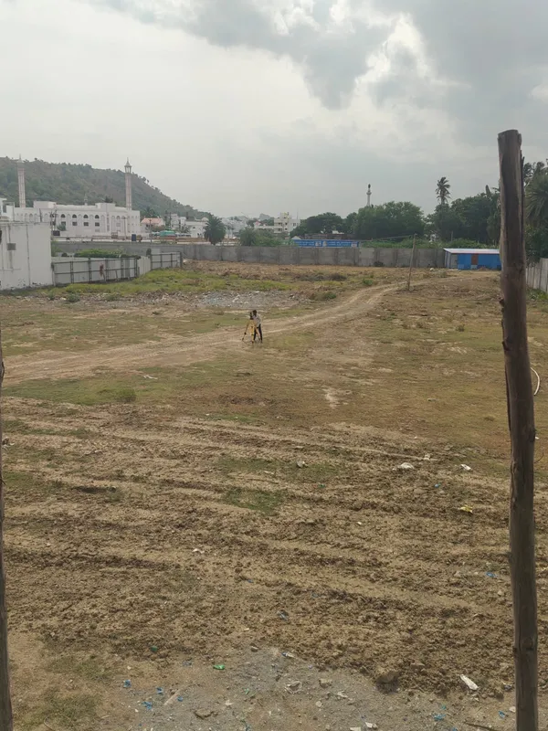
Boundary fixing in DGPS Instrument
Boundary fixing in DGPS Instrument12.9981° N · 80.0742° E
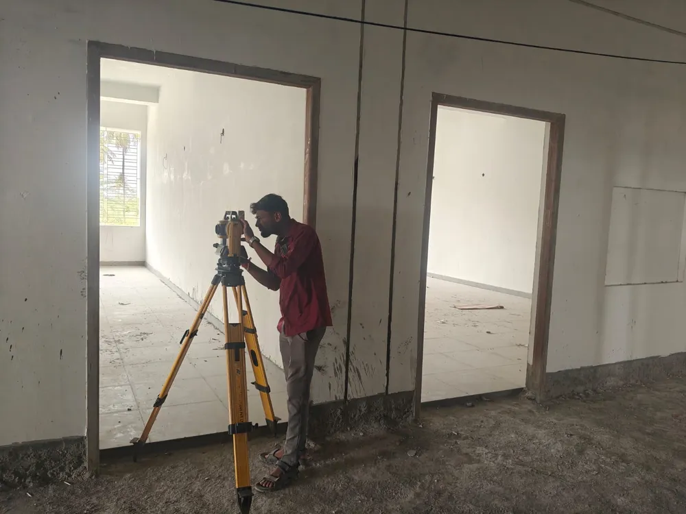
Building As-Build survey
Building As-Build survey13.0145° N · 80.1203° E
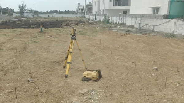
Construction marking
Construction marking12.9456° N · 79.9912° E
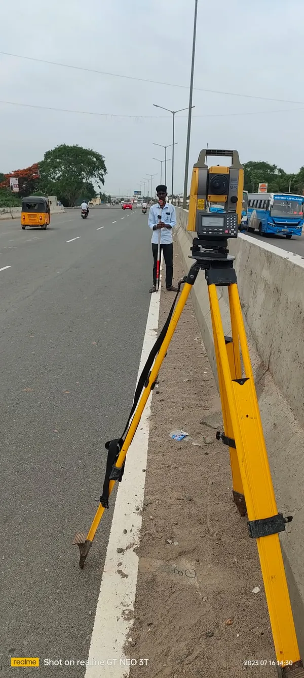
Road survey
Road survey13.0876° N · 80.2014° E
Topo Graphical survey
Topo Graphical survey12.8834° N · 80.0521° E
/ 04 IN THEIR WORDS

Real words from real sites. We'll publish these as our clients send them in.

TRUSTED BY BUILDERS, CONTRACTORS AND DESIGN STUDIOS

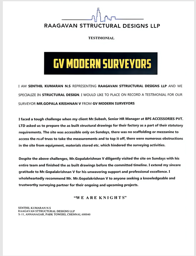
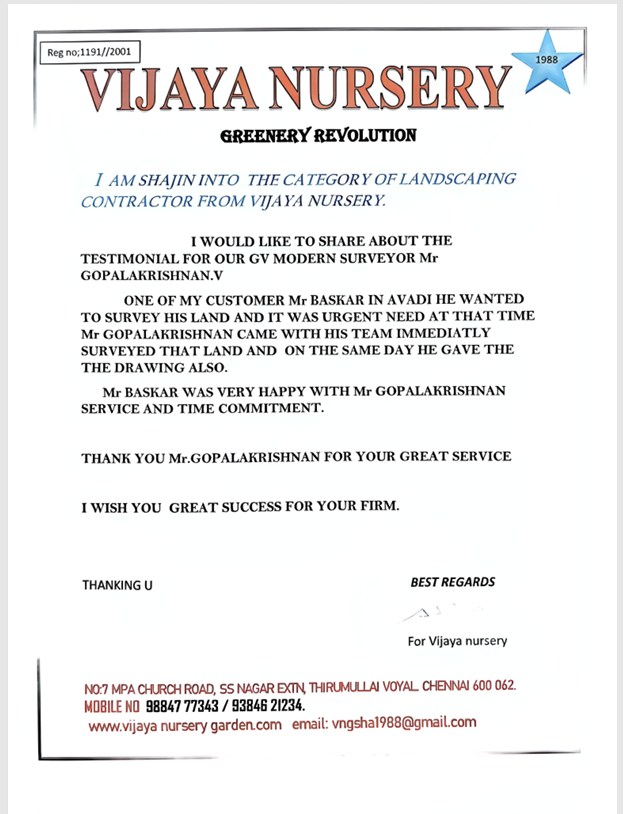
OFFICIAL APPRECIATION

Testimonial Document 1
Testimonial Document 2
Testimonial Document 3
/ 05 KNOWLEDGE BASE

Frequently Asked
Questions.

Clear, concise answers to the most common queries about our field surveying operations, timelines, and technical processes.

What is a topographical survey?

+

A topographical survey maps the physical features of a property, including boundaries, elevations, trees, and existing structures. It is essential for architects, engineers, and builders before starting any construction project.

How much does a land survey cost in India?

+

The cost of a land survey depends on the size of the property, the complexity of the terrain, and the type of survey required (e.g., FMB verification vs. DGPS). Contact us with your property details for a precise, customized quote.

What is an FMB sketch?

+

An FMB (Field Measurement Book) sketch is a government record that outlines the exact dimensions and boundaries of a specific land parcel. We provide precise FMB drawing works to resolve boundary disputes and ensure legal compliance.

How long does a typical land survey take?

+

Most residential and small commercial surveys can be completed in 1 to 2 days of field operations, followed by 1 to 3 days for data processing and drawing delivery. Large-scale projects may take longer.

Why use DGPS surveying over traditional methods?

+

Differential Global Positioning System (DGPS) surveying offers millimeter-level accuracy over vast distances in a fraction of the time. It is highly precise, reducing human error and providing reliable data for critical infrastructure projects.

/ 05 REACH US

Based in Chennai. Working across India.

No.117, Sammandhan Nagar Main Road, Kundrathur, Chennai 600069.
Field teams cover all of South Chennai daily, with project work nationwide.
Reach us on WhatsApp or call. We reply the same day, every day.
Surveyor in Kundrathur Topographic survey Porur Topographic survey Tambaram
13.0023° N · 80.0945° E

Tell us where
your site is.

Send an enquiry to check availability and get an exact quote. Most surveys can be scheduled for the very next morning.

Or call us directly at
+91 80728 07474
/ INITIATE ENQUIRY

This will open WhatsApp with your details pre-filled.